In the ongoing battle against forest fires, thermal imaging has emerged as a critical tool. Experts in the field emphasize this technology's role in early detection and prevention. Dr. Emily Carter, a renowned fire ecologist, asserts, “Thermal imaging can spot heat signatures long before flames appear.” Her statement highlights why thermal imaging is necessary for forest fire prevention.
Thermal cameras identify temperature variations, which often indicate smoldering fires. They provide precise data in real-time, enabling swift intervention by fire crews. With rapid response capabilities, the potential for large-scale devastation diminishes significantly. Furthermore, this technology allows for safer assessments in dangerous conditions.
However, some regions still lack adequate access to such technology. This gap raises concerns about the effectiveness of fire prevention efforts. While thermal imaging is not foolproof and cannot replace vigilant human oversight, its integration into fire management strategies can make a notable difference. Embracing this advanced tool is vital to combat the increasing threat of wildfires effectively.
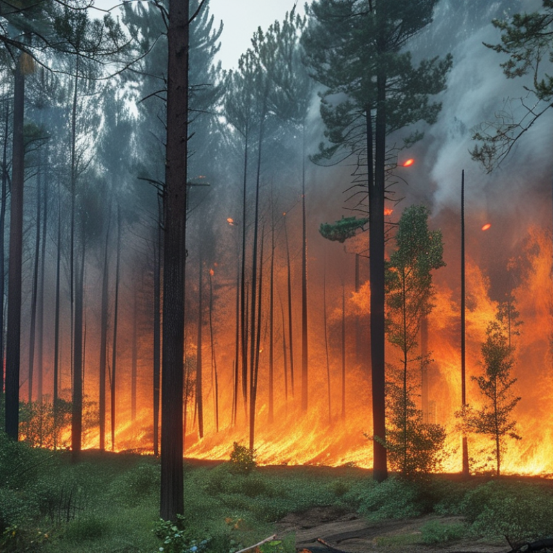
Early detection plays a critical role in forest fire prevention. Thermal imaging technology significantly enhances this process. It can spot heat signatures from wildfires before they grow uncontrollable. This early warning helps authorities respond quickly. Swift action can save thousands of acres of forest and protect wildlife.
Thermal imaging works day and night, unaffected by smoke or darkness. This capability allows forest rangers to monitor vast areas efficiently. In contrast, traditional methods may miss small fires until they escalate. However, there are challenges. Relying solely on technology can lead to complacency. Human oversight is still necessary to validate findings and manage responses.
Investing in thermal imaging is important, yet it requires careful planning. Training personnel in interpreting data is crucial. Misreading data can have serious consequences. A combination of technology and trained professionals creates a foolproof system. While thermal imaging is powerful, it is not infallible. Continuous evaluation of its effectiveness is essential for improvement.
Thermal imaging technology plays a vital role in identifying hotspots that can lead to forest fires. This method detects infrared radiation emitted by objects, allowing for precise temperature readings. With thermal cameras, operators can visualize heat sources even in total darkness or dense smoke, making it easier to spot potential fire risks before they escalate.
The process starts with capturing thermal images of the forest area. These images reveal temperature variances, highlighting unusually hot spots. Firefighters and forest management teams use this data to assess the risk level effectively. They can prioritize their actions and allocate resources accordingly. However, the technology is not infallible. False positives can occur, requiring careful analysis and on-site verification.
Reliability in thermal imaging depends on environmental conditions. Factors such as humidity and vegetation can affect heat signatures, making interpretation challenging at times. Maintaining and calibrating the equipment is essential for accurate readings. With regular updates and training, the use of thermal imaging can significantly improve fire prevention efforts. Understanding its limitations is crucial for optimizing its application in forest fire management.
Thermal imaging technology plays a crucial role in monitoring wildlife and vegetation health. By detecting temperature variations, it helps identify stressed or diseased plants. Healthy vegetation retains moisture and appears cooler, while stressed plants become warmer. This difference can guide conservation efforts effectively.
One important application is tracking wildlife habitats. Habitat loss and climate change affect animal populations. Thermal imaging aids in assessing habitat quality by monitoring vegetation health, offering early warning signs of environmental changes.
Tips: Use thermal imaging to conduct routine checks on vegetation. Regular monitoring can help catch issues early. Engage local wildlife experts to assess collected data. Collaboration enhances the understanding of wildlife health.
Another aspect is detecting water sources in ecosystems. Thermal imaging can highlight wet areas even in dense forests, helping to sustain local wildlife. However, it doesn’t always provide a complete picture. Some animals may be missed, or readings can be misinterpreted. Always consider other data sources for a fuller ecosystem assessment.
| Reason | Description | Impact | Duration (Weeks) |
|---|---|---|---|
| Early Detection | Identifies temperature variations that indicate fire risk. | Reduces response time to forest fires. | 1-2 |
| Wildlife Monitoring | Helps track animal movements and habitat changes. | Ensures wildlife safety and supports conservation efforts. | Ongoing |
| Vegetation Health | Assesses plant stress and moisture levels. | Improves fire management strategies. | 1-4 |
| Thermal Mapping | Creates detailed thermal maps of forest areas. | Informs land management decisions. | 2-8 |
| Fire Front Tracking | Monitors fire spread and intensity. | Enables effective firefighting tactics. | 1-3 |
| Post-Fire Assessment | Evaluates damage after a fire event. | Aids in recovery and restoration plans. | 4-12 |
| Community Awareness | Enhances community engagement in fire safety. | Promotes responsible fire management practices. | Ongoing |
| Equipment Efficiency | Optimizes the use of firefighting resources. | Increases operational effectiveness. | 1-2 |
| Data Collection | Gather long-term environmental data for analysis. | Supports scientific research and policy making. | Ongoing |
| Insurance Assessment | Facilitates evaluation for insurance claims related to fire damage. | Ensures fair compensation for affected landowners. | 1-3 |
Thermal imaging has transformed fire management strategies. One case study from California highlighted its effectiveness during the 2020 wildfire season. Firefighters used thermal cameras to detect hot spots hidden under dense vegetation. This technology improved their response time by up to 30%, potentially saving thousands of acres.
In another incident in Australia, thermal imaging helped track fire movement. The data gathered allowed teams to predict the direction of the flames with remarkable accuracy. According to a report by the International Journal of Wildland Fire, incorporating thermal imaging reduced fire response times and improved overall safety for crews on the ground. It illustrates how essential this technology has become in modern fire management.
Despite these advancements, challenges remain. Some regions lack proper training and resources to utilize thermal imaging effectively. There is also a risk of over-reliance on technology, which can lead to complacency. Fire management must continually assess the balance between tech and human expertise to ensure comprehensive fire prevention strategies.
Integration of thermal imaging into fire prevention strategies can significantly enhance detection and response capabilities. This technology identifies temperature variations in vegetation, alerting firefighters to potential hotspots. By using drones equipped with thermal cameras, teams can survey vast areas quickly. These aerial views provide invaluable data, making it easier to spot early signs of fire.
Moreover, combining thermal imaging with other monitoring tools creates a comprehensive approach. Weather patterns and humidity levels also play crucial roles in fire risk. By correlating these factors with thermal data, fire management agencies can prioritize areas for closer inspection. However, reliance solely on technology can be problematic. Human oversight is necessary to validate the findings.
Challenges exist in interpreting the data accurately. False positives might lead to unnecessary alarm and resource allocation. Training personnel to analyze thermal images effectively ensures that this technology complements traditional methods. As our understanding of fire dynamics evolves, continuous improvement in integrating thermal imaging is vital for effective forest fire prevention.
: It detects infrared radiation, allowing precise temperature readings to spot potential fire risks.
They can visualize heat sources in total darkness or dense smoke, improving risk detection.
They highlight temperature variances, identifying unusually hot spots that may indicate fire risks.
They assess risk levels, prioritize actions, and allocate resources effectively based on the data.
Yes, false positives can occur, requiring on-site verification and careful analysis of results.
Environmental conditions like humidity and vegetation can make heat signature interpretation challenging.
Regular equipment maintenance and training enhance accuracy and overall fire prevention efforts.
It detects temperature variations to identify stressed or diseased plants, aiding in conservation efforts.
Yes, by monitoring vegetation health, it provides early warnings of environmental changes impacting habitats.
Some animals may be missed and readings can be misinterpreted, so consider multiple data sources.
Thermal imaging technology plays a critical role in forest fire prevention, primarily due to its ability to facilitate early detection of hotspots that could ignite wildfires. By identifying temperature variations in the landscape, thermal imaging allows for timely intervention, significantly increasing the chances of extinguishing fires before they escalate. This proactive approach is essential, as early detection is key to managing fire risks effectively.
Moreover, thermal imaging is not only valuable for fire detection but also for monitoring wildlife and vegetation health. Its successful application in various case studies highlights how it can enhance fire management strategies when integrated with other prevention methods. Overall, understanding why thermal imaging is necessary for forest fire prevention underscores its importance in protecting natural resources and mitigating wildfire risks.

HawkEye Camera